Cirra AI — Complete Capabilities
Everything Cirra can do — 23+ AI tools, 5+ channels, 70+ data sources, 9+ expert knowledge domains.
The definitive reference for every Cirra AI capability — parameters, outputs, examples, and thresholds.
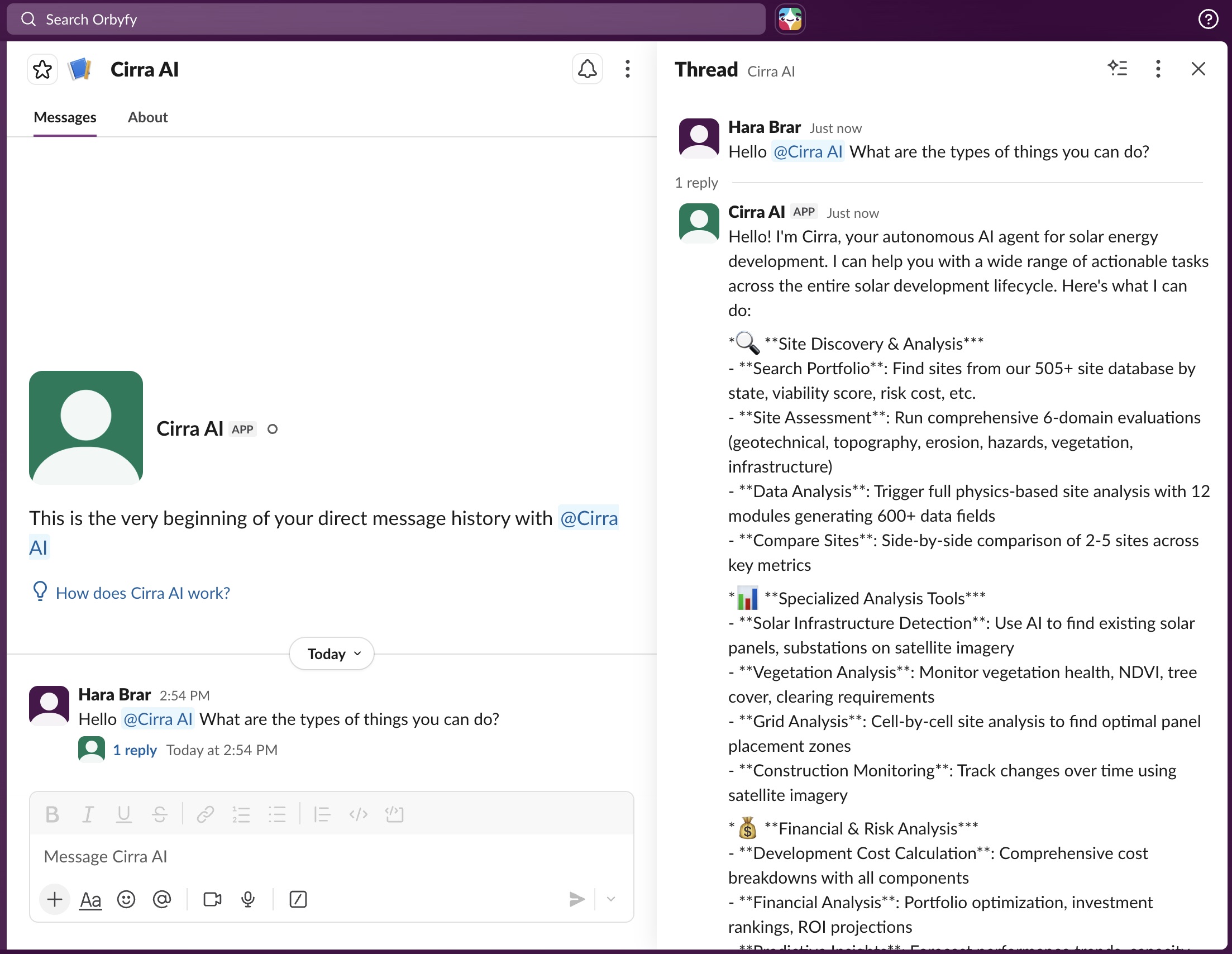
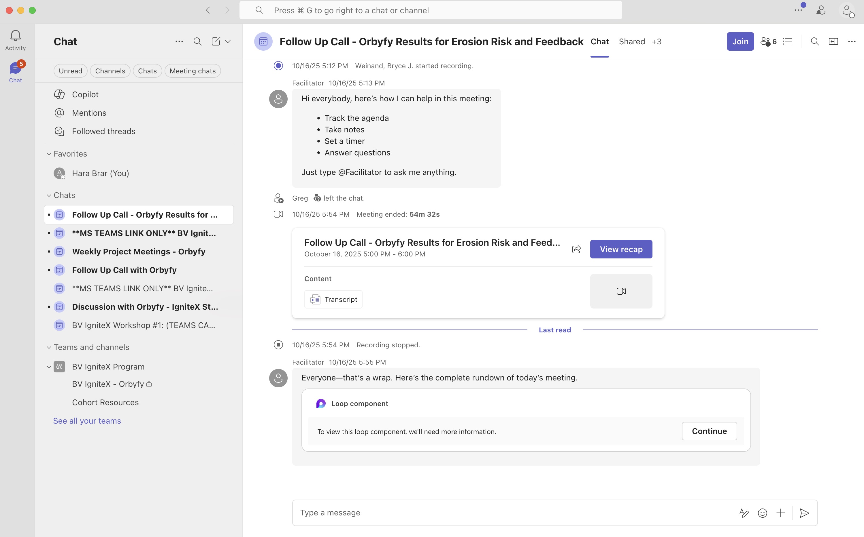
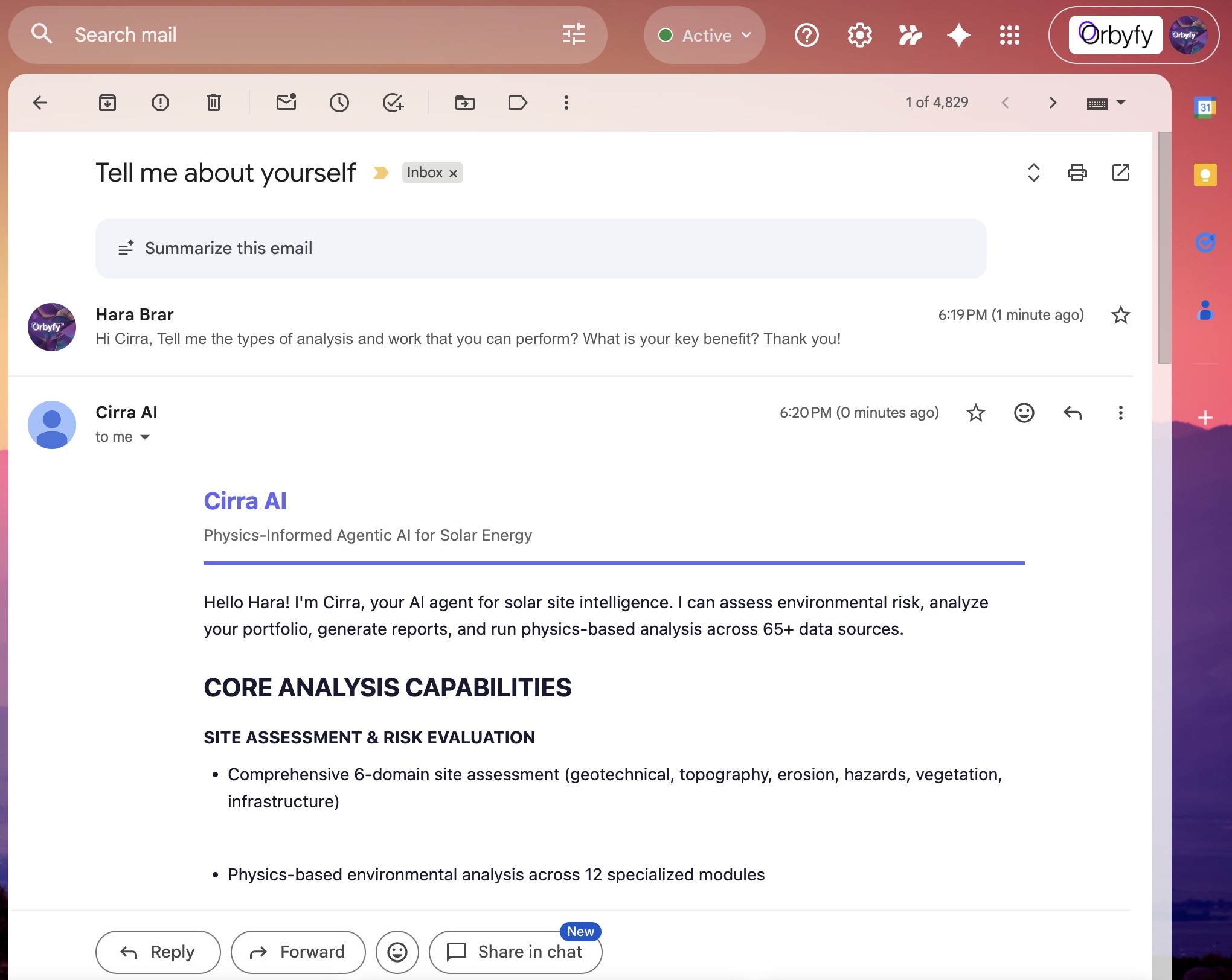
Talk to Cirra Anywhere
All channels have full feature parity. Cirra lives everywhere. Convenient communication channels.
23 Agent Tools
Every tool Cirra uses — click any card to expand full parameters, outputs, data sources, and example prompts.
| Name | Type | Req | Description |
|---|---|---|---|
| site_name | string | Yes | Name of the solar site |
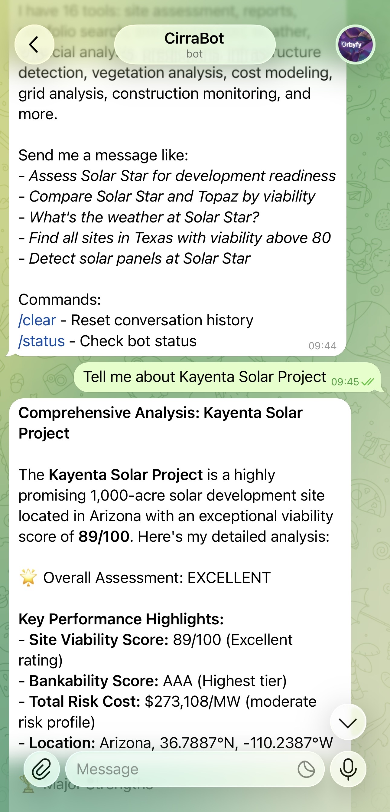
overallRating composite viability • redFlags[] ranked by severity • recommendations[] actionable mitigations • costImplications dollar impact • 6 domain assessments: geotechnical (bearing capacity, drainage, foundation type), topography (slope, aspect, tracker suitability), erosion (RUSLE, soil loss tons/acre/yr), hazards (hail, flood, seismic PGA), vegetation (tree cover %, clearing cost), infrastructure (transmission distance, gen-tie estimate)- Assess Kayenta Solar Farm
- What are the risks at Solar Star?
- Is Topaz buildable?
- Evaluate this site for development
- Run a full due diligence on Desert Sunlight
- What are the geotechnical concerns at this location?
| Name | Type | Req | Description |
|---|---|---|---|
| site_name | string | Yes | Name of the solar site |
Optional: Atlas14/NREL, Wind Analysis, SMAP Moisture, MODIS ET, Hail Analysis
run_site_analysis first- How complete is the data for Kayenta?
- Do we have enough data to assess Solar Star?
- What modules are missing?
- Is the data complete enough for a bankability assessment?
- Which critical modules need to be run?
| Name | Type | Req | Description |
|---|---|---|---|
| site_name | string | Yes | Name for the site |
| latitude | number | Yes | Latitude (24–49 N for CONUS) |
| longitude | number | Yes | Longitude (-125 to -66 W) |
field_count (600+) • modules_completed • kpi_count • duration_seconds • success_rate- Analyze a new site at 34.8N, 118.4W called Solar Star
- Run a full analysis for Kayenta
- Add this location to the portfolio and analyze it
- Analyze coordinates 35.37N, 120.06W as Topaz Solar
- Rerun the analysis for Kayenta with updated data
| Name | Type | Req | Description |
|---|---|---|---|
| site_name | string | Yes | Name of the solar site |
| fields | string[] | No | Specific field names |
| category | string | No | Data category filter (see below) |
soil topography climate flood seismic wind vegetation erosion kpi solar_resource soil_moisture evapotranspiration hail satellite site_info all
- What's the bearing capacity at Kayenta?
- Show me all soil data for Solar Star
- Give me the raw KPI data
- What's the slope and elevation?
- Show me the flood risk data for Kayenta
- What are the seismic parameters?
| Name | Type | Req | Description |
|---|---|---|---|
| site_name | string | Yes | Full or partial site name |
found boolean • match_count • sites[] with lat/lng, state, viability, bankability grade, risk cost, completeness %, satellite map preview • confidence match level- Find Solar Star
- Look up Kayenta
- Which site matches 'Topaz'?
- Do we have a site called Copper Mountain?
- Show me the satellite preview for Kayenta
| Name | Type | Req | Description |
|---|---|---|---|
| location | string | Yes | City, address, or landmark |
candidates[] lat/lng, place name, state, relevance score • conus_candidates count within CONUS (24–49N, -125 to -66W)- Geocode near Bakersfield CA
- Where is Kayenta, Arizona?
- I want to analyze a site near Phoenix
- Geocode 123 Main St, Phoenix AZ
- Find the coordinates for Mojave Desert area
| Name | Type | Req | Description |
|---|---|---|---|
| site_name | string | Yes | Name of the solar site |
GHI Global Horizontal Irradiance (annual + monthly) •
DNI Direct Normal Irradiance •
DHI Diffuse Horizontal Irradiance •
capacityFactor PVWatts-based •
energyYield kWh/kWp/year •
performanceRatio •
peakSunHours •
25yr_production degradation-adjusted •
resourceClassification Excellent/Good/Moderate/Fair/Poor
- What's the solar resource at Kayenta?
- How much energy will Solar Star produce?
- What's the GHI and DNI for this site?
- What's the capacity factor at Topaz?
- Is the solar resource excellent or just good here?
- How many peak sun hours does this location get?
| Name | Type | Req | Description |
|---|---|---|---|
| site_name | string | No | Solar site name |
| latitude | number | No | Latitude (if no site_name) |
| longitude | number | No | Longitude (if no site_name) |
Peat Fire — peat classification (Fibric/Hemic/Sapric), organic matter %, estimated depth, subsurface moisture, moisture deficit score, KBDI, smoldering ignition risk, spread rate (cm/hr), burn depth, days to extinguish, detection difficulty
Combined — overall fire risk score and level
Mitigation — strategies, monitoring requirements, cost/acre, insurance surcharge %, construction delay days, seasonal restrictions
- What's the fire risk at Kayenta?
- Is there peat fire danger at this site?
- Assess wildfire risk for Solar Star
- What fire mitigation measures are needed?
- Is the soil combustible at this location?
| Name | Type | Req | Description |
|---|---|---|---|
| site_name | string | No | Solar site name (looks up coords) |
| latitude | number | No | Latitude (if no site_name) |
| longitude | number | No | Longitude (if no site_name) |
| source | string | No | extents / high-res / low-res / all |
| image_url | string | No | URL for Image Mode |
| segment_classes | string[] | No | Classes to detect |
High-Res — Gemini 2.5 Flash + Mapbox, ~1m res, panels/substations/inverters
Low-Res — Gemini 2.5 Flash + Sentinel-2, 10m res, ~6.4km area coverage
- Detect solar panels at Solar Star
- Find all infrastructure at 34.8N, 118.4W
- Segment this satellite image for solar panels
- Map the solar farm boundaries at Topaz
- Show me an annotated image of the detection results
- Run all three detection sources on this site
| Name | Type | Req | Description |
|---|---|---|---|
| site_name | string | No | Solar site name |
| baseline_date | string | Yes | Baseline date (YYYY-MM-DD) |
| current_date | string | Yes | Comparison date (YYYY-MM-DD) |
baseline • current NDVI statistics • changes vegetation loss %, construction indicators • progress construction assessment- What's changed at Solar Star since January 2024?
- Show construction progress from 2024-01 to 2025-12
- Compare before and after for Kayenta
- Has vegetation been cleared at this site since last year?
- Track construction activity from March to December 2025
| Name | Type | Req | Description |
|---|---|---|---|
| site_name | string | Yes | Name of the solar site |
| grid_size | number | No | 5 (25 cells), 10 (100, default), 25 (625) |
cellCount • averageDataQuality • results[] per-cell viability, cost, risk factors • analysisId- Run a grid analysis for Kayenta
- Where should we place panels at Solar Star?
- Show me a heatmap of site suitability
- Analyze the spatial variation across the site
- Use a 25x25 grid for more detail
| Name | Type | Req | Description |
|---|---|---|---|
| site_name | string | No | Solar site name |
| latitude | number | No | Latitude |
| longitude | number | No | Longitude |
| include_temporal | boolean | No | Include 12-month NDVI trend |
- How healthy is the vegetation at Kayenta?
- What's the erosion risk?
- Show me the 12-month vegetation trend
- What's the NDVI for Solar Star?
- Give me the full RUSLE breakdown
- What vegetation clearing will be needed?
| Name | Type | Req | Description |
|---|---|---|---|
| site_name | string | No | Solar site name |
| latitude | number | No | Latitude |
| longitude | number | No | Longitude |
- What vegetation is growing at Kayenta?
- What grass types are at Solar Star?
- Is there invasive species risk?
- Identify the vegetation species
- Is there C3 or C4 grass at this location?
| Name | Type | Req | Description |
|---|---|---|---|
| site_name | string | Yes | Solar site name |
| category | string | No | all / permits / zones / seeding_plans / monitoring |
permits[] active permits, expiration flags • zones[] by type with acreage • seeding_plans[] species, seed rates, cost estimates • monitoring NDVI trend (increasing/stable/decreasing), 12-month snapshots- Are permits current for Kayenta?
- What vegetation zones are defined?
- Show me the seeding plan
- What's the NDVI monitoring trend?
- Are any permits about to expire?
| Name | Type | Req | Description |
|---|---|---|---|
| site_name | string | Yes | Solar site name |
| cost_assumptions | object | No | Override defaults (module_cost_per_mw, inverter_cost_per_mw, tracker_cost_per_mw, itc_rate, etc.) |
SSURGO_Bearing_Capacity_ksf → foundation type • GEE_SRTM_Slope_Degrees → grading cost • KPI_Nearest_Transmission_Distance_km → gen-tie • GEE_Hansen_Tree_Cover_Percent → clearing cost • Enhanced_Seismic_Design_Category → seismic uplift- How much would it cost to develop Kayenta?
- Give me an EPC cost breakdown for Solar Star
- What if module prices drop to $250K/MW?
- What are the top cost drivers?
- Compare development costs for Kayenta vs Solar Star
- What if we use helical piles instead of driven?
| Name | Type | Req | Description |
|---|---|---|---|
| site_names | string[] | No | Sites to analyze |
| prediction_type | string | No | comprehensive / financial_forecast / sensitivity_analysis / risk_evolution / portfolio_optimization |
| time_horizon | number | No | Years (default 5, max 25) |
| investment_budget | number | No | Budget in USD |
| market_assumptions | object | No | energy_price_kwh, discount_rate, degradation_rate, itc_rate, etc. |
- What's the NPV and IRR for Kayenta?
- Run a sensitivity analysis on energy prices
- How should I allocate a $50M budget across the portfolio?
- What if I use a 10% discount rate instead?
- Give me the LCOE for the top 5 sites
- What are the long-term risk trends?
| Name | Type | Req | Description |
|---|---|---|---|
| site_name | string | Yes | Solar site name |
| project_size_mw | number | No | Expected project size in MW (overrides Firestore capacity if provided) |
compositeScore (0–100) weighted EPC Bid Readiness • Per-category scores with traffic-light ratings (Favorable/Acceptable/Marginal/Unfavorable) • redFlags[] • costImpact per category • recommendation Go/No-Go/Conditional • topRiskDrivers[] • topCostDrivers[] • Total development cost range (low/mid/high $/MW)- Evaluate the EPC bid for Kayenta
- Run an EPC assessment for Solar Star
- Is this site ready for procurement?
- What's the bid readiness score for Topaz?
- EPC bid evaluation for a 200MW project at Desert Sunlight
- What are the top cost drivers for an EPC bid?
| Name | Type | Req | Description |
|---|---|---|---|
| site_name | string | No | Solar site name |
| latitude | number | No | Latitude |
| longitude | number | No | Longitude |
current temp, humidity, wind, UV, precip, visibility, cloud cover • hourly[] 48-hour • daily[] 7-day with cross-source confidence- What's the weather at Kayenta?
- Will it rain at Solar Star this week?
- Current conditions at 34.8N, 118.4W
- Is there a storm coming to Solar Star?
- What's the UV index at Kayenta right now?
| Name | Type | Req | Description |
|---|---|---|---|
| site_name | string | No | Solar site name |
| activity | string | No | all / general_construction / crane_operations / panel_installation / electrical_work / concrete_work / earthwork |
- Can we pour concrete at Kayenta this week?
- When is it safe to do crane operations?
- Optimal work windows for panel installation?
- What's the construction forecast for Solar Star?
- Best days for earthwork this week?
| Name | Type | Req | Description |
|---|---|---|---|
| site_name | string | Yes | Solar site name |
| report_type | string | Yes | See types below |
executive_summary ~200 words •
geotechnical ~400 words •
risk_assessment ~400 words •
construction_readiness ~400 words •
bid_support ~400 words •
full ~1,500 words
- Generate an executive summary for Kayenta
- Construction readiness report for Solar Star
- Give me a risk assessment report
- Bid support report for Topaz
- Generate the full combined report
| Name | Type | Req | Description |
|---|---|---|---|
| site_name | string | Yes | Solar site name |
| report_type | string | No | full (default) / executive / geotechnical / environmental |
full 20–30 pages, all 12 modules •
executive 3–4 pages, summary + KPIs •
geotechnical 8–10 pages •
environmental 8–10 pages
downloadUrl signed URL (7-day) • pageCount • fieldCount • fileSize- Generate a PDF report for Kayenta
- I need a downloadable executive summary
- Send me the full geotechnical report as PDF
- Environmental PDF report for Solar Star
- Download the full 30-page report
| Name | Type | Req | Description |
|---|---|---|---|
| state | string | No | US state filter |
| min_viability | number | No | Minimum viability (0–100) |
| max_risk_cost | number | No | Maximum risk cost ($) |
| sort_by | string | No | Field to sort by |
| limit | number | No | Max results (default 10) |
- Show me the top 10 sites in California
- Find sites with viability above 80
- Which sites have the lowest risk cost?
- List all sites in Texas sorted by bankability
- Show me sites with risk cost under $50K/MW
| Name | Type | Req | Description |
|---|---|---|---|
| site_names | string[] | Yes | 2–5 site names to compare |
- Compare Solar Star vs Topaz vs Desert Sunlight
- Which is better: Topaz or Desert Sunlight?
- Compare Kayenta and Solar Star
- Compare the top 3 California sites
- Which has better bearing capacity: Topaz or Desert Sunlight?
8 Intelligent Workflow Chains
Cirra automatically chains tools together based on your intent. Say the trigger phrase and Cirra handles the rest.
9 Expert Domains
Deep domain expertise across engineering, regulatory, and financial disciplines.
Unmatched Data Coverage
70+ authoritative data sources powering every analysis.
Automatic Red Flags
Cirra automatically flags these critical risk thresholds in every assessment.
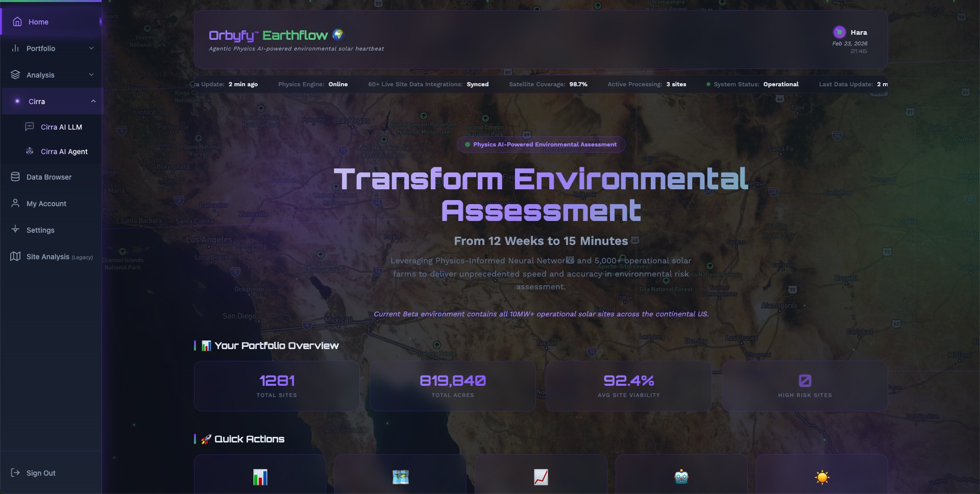
Experience Cirra AI
Try the autonomous AI agent for solar site intelligence.